The essays collected in Deep Maps and Spatial Narratives, edited by David Bodenhamer, John Corrigan, and Trevor M. Harris play with the relationships between place, space, and time through the lens of a fairly new trend in humanities scholarship – the deep map. Before tackling this theoretical deep dive, I was not a complete stranger to the deep map.
My sophomore year as a student at Saint Louis University (#rollbills), I spent my spring semester studying abroad in Rome – eating amazing pasta, finding out how much gelato I could consume in one day, and traveling Europe sobbing with joy at historic sites and buildings. Shockingly to some (mostly my parents), I also went to class sometimes.
In one of my history classes, I was given a rather unconventional final project – instead of a paper, we were tasked with creating a deep map that told a story (of our choosing) about the history of Rome, connecting places with their dynamic stories across time.
I chose to create a map that would tell the story of the Ancient Egyptian influence on Rome. This included everything from stolen obelisks that tower above tourists and the aggravated Romans avoiding them in a few of the city’s piazzas to a burial place for an Ancient Roman senator inspired by the pyramids of Giza and finally, a massive white marble obelisk emblazoned with fascist dictator Benito Mussolini’s name that still stands to this day.
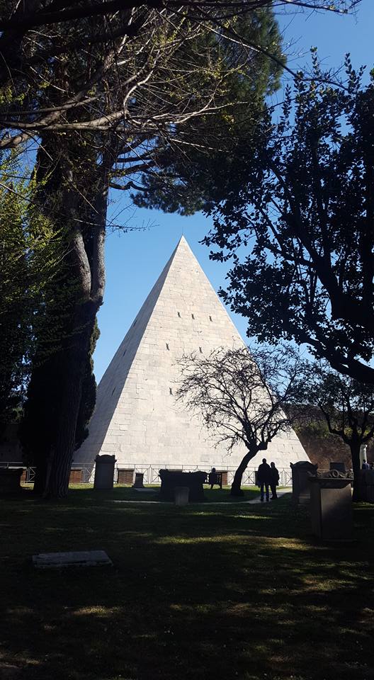
View from the Protestant Cemetery
Rome, Italy
Taken by me
The Egyptian influences in Rome have more to do with than just simply aesthetics. They are symbols of the political obsession with supremacy, conquering, and grandeur. The Ancient Romans could point to their obelisks with pride to show that they had conquered the Egyptian corner of the world along with many others. The popes then shuffled the obelisks around the city, placing them in front of churches like St. Peter’s Basilica to show that they and the Church reigned supreme. Finally, Mussolini built his own modern obelisk to draw a straight, unbroken line between his power and the might of the Roman Empire. The fact that his name still stands tall next to the Tiber River also makes a powerful statement about Italy’s (and Europe’s) slow slide back into far-right politics.
My partner and I created our deep map using Prezi. At the time, I thought it was a fairly unsophisticated way to go about it, but it was the best we could do considering neither of us had any experience with (or access to) more complicated technologies like GIS. It was reassuring to see one of the collection’s authors, Trevor M. Harris, directly mention Prezi as a useful and valid tool for the task of creating a deep map.
With this brief foray into the world of deep maps in mind, I found it fascinating to hear from the experts in the field. I found Harris’s definition of deep mapping particularly illustrative:
To him, a deep map, “interweaves physical geography and scientific analysis with biography, folklore, narrative, text, memories, emotions, stories, oral histories, and so much more to contribute to a richer, deeper mapping of space and place” (39).
This quick definition expands the possibilities of a deep map much farther than I had imagined in my undergraduate class. It also opens up so many opportunities to turn a deep mapping project into a public history project that invites the general public to share their experiences of place and space over time. A deep map could also easily be incorporated into an exhibit or live within a museum’s digital presence.
These readings left me feeling not only nostalgic about my time abroad, but also inspired by the possibilities that deep maps represent.

I really like the example you gave of your deep map assignment in Rome – this is a great way to illustrate the point that deep maps are not necessarily things that are inaccessible to the public. Recognizing that deep maps can be educational and appealing without delving into the complications of GIS technology is so important in the public history field, especially with the possibility of working in institutions that might not have the budget to utilize some of those more expensive technologies.
LikeLiked by 1 person